
The National Transportation Safety Board has released its preliminary report into a fatal plane crash of Piper PA-32-300 near Empire on May 17, providing new details about the aircraft’s final minutes before it disappeared from radar.
According to the National Transportation Safety Board in an online post, the report outlines the flight path, weather conditions, and initial findings from the ongoing investigation into the May 17 crash of a Piper PA-32-300.
Investigators said the plane departed Reno Stead Airport at about 7:03 a.m. on a personal flight destined for Sunrise Skypark Airport in Marsing, Idaho.
Preliminary ADS-B data showed the aircraft initially climbed to about 9,700 feet before turning northwest and continuing to gain altitude. The plane later turned north and climbed to a maximum altitude of about 14,700 feet before making a right turn and entering a descending spiral.
The last radar data showed the aircraft about 6 nautical miles southwest of Empire at an altitude of 11,275 feet and traveling at 167 knots ground speed.
Preliminary air traffic control audio reviewed by investigators revealed the pilot told controllers he was in clouds and intended to turn around. Air traffic control cleared the pilot to maneuver back toward Reno before communication was lost. An alert notice was later issued after the aircraft disappeared from radar.
The report also detailed weather conditions in Northern Nevada at the time of the crash. Investigators said a cold front was moving south across the region, with a freezing level of about 6,300 feet. Cloud bases were reported near 8,000 feet, and icing conditions extended to about 18,000 feet near the crash site.
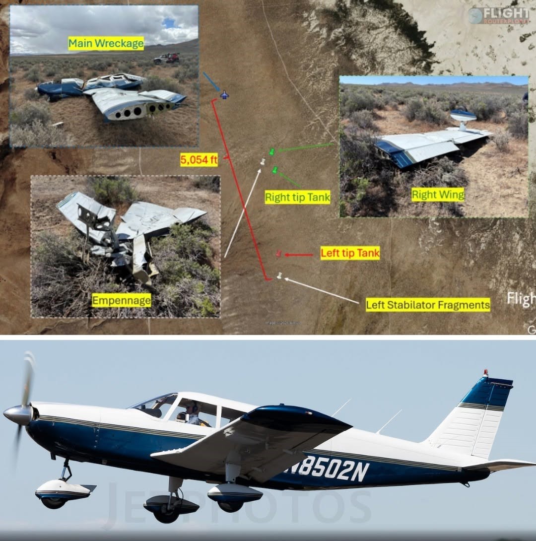
The wreckage was later located southwest of Empire in desert terrain. Investigators documented a debris field measuring about 5,054 feet long and 2,555 feet wide, with all major aircraft components found within the area.
The report describes significant damage to the aircraft, including separated wing and tail components found throughout the debris field. The engine remained attached to the fuselage and was recovered along with the rest of the aircraft for further examination