

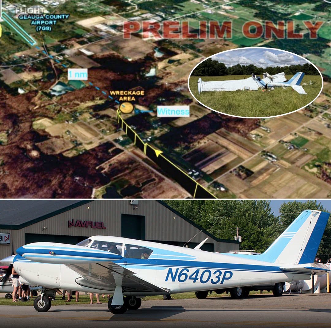
The National Transportation Safety Board (NTSB) has released its preliminary investigation report into the tragic June 20, 2026 crash of a Piper PA-24-250 (registration N6403P) near Middlefield, Ohio, that claimed the lives of the pilot and two passengers.
While the report provides important new details about the aircraft’s final minutes, investigators have not yet determined the probable cause.
According to the report, the aircraft departed Youngstown/Warren Regional Airport at approximately 3:24 p.m. on a short 21-nautical-mile personal flight to Geauga County Airport. Flight tracking data showed the airplane climbed to about 2,300 feet before beginning its descent toward Runway 29.
About two miles from the runway, the aircraft unexpectedly entered a descending right turn. Radar contact ended roughly one nautical mile east of the airport at an altitude of about 1,345 feet and a groundspeed of approximately 63 knots.
One of the most significant findings comes from air traffic control communications. Shortly after takeoff, controllers warned the pilot about an area of moderate weather northwest of the departure airport and advised deviations if necessary.
The pilot responded that the precipitation appeared light and that they could see through it. Minutes later, as the aircraft approached its destination, the pilot reported not having the airport in sight and requested to cancel flight following. Radar services ended at 3:29 p.m., and by 3:35 p.m. the aircraft had disappeared from radar. No further radio transmissions were received.
A witness reported seeing the airplane flying straight and level before the right wing suddenly dipped. The aircraft briefly recovered before making a sharp right turn and entering a steep nose-down descent into a cow pasture approximately one nautical mile east of the airport.
Investigators determined that the first point of impact was consistent with the aircraft’s right wingtip fuel tank striking the ground, followed by engine impact. The wreckage was confined to a relatively small debris field measuring about 50 feet by 40 feet. Flight control continuity was confirmed throughout the aircraft, and the engine remained attached to the fuselage. Two propeller blades appeared largely undamaged, while a third blade was bent aft after being dislodged from the hub, providing investigators with additional evidence for further examination.
Weather at the time of the accident included 10 miles of visibility, scattered clouds at 4,700 feet, broken clouds at 6,500 feet, and light winds of 7 knots. The aircraft has since been moved to a secure facility, where investigators will continue examining the airframe, engine, weather conditions, and other evidence before issuing a final report and determining the probable cause of the accident.