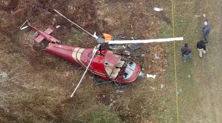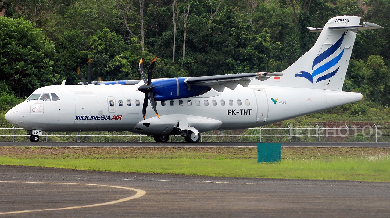
On Jan 17th 2026, an IDA Indonesia Air Transport ATR-42-500 disappeared from radar while approaching Makassar in Indonesia, later to be found wrecked high on the slopes of Mount Bulu Saraung, with no survivors among the 10 people on board.
The aircraft, registered PK-THT, was operating a flight from Yogyakarta to Makassar with 6 passengers and 4 crew when radar and radio contact were lost near the destination. According to AirNav Indonesia, the last recorded position was 04°57’08” south and 119°42’54” east at 13:17 local time. At that moment, the turboprop was descending toward Makassar for its approach, having already been cleared for runway 21.
Indonesia’s Civil Aviation Authority later confirmed that air traffic control noticed the aircraft was not following the correct approach path and instructed the crew to realign with the approach. Contact was lost about 11 nautical miles northeast of the runway threshold, triggering an immediate search and rescue operation.
Emergency responders faced extremely difficult conditions, with heavy fog and rain hampering access to the mountainous terrain. Local residents in the Mount Lapiau and Leang-Leang areas reported hearing an explosion around the time contact was lost, followed by smoke rising from the mountainside, strengthening fears of a crash in the rugged national park region.
Search and Rescue teams initially believed the aircraft had gone down inside the Bantimurung Bulusaraung National Park. Later the same day, the local disaster management agency reported that wreckage had been located near the peak of Mount Bulu Saraung, rising to more than 5,100 feet above sea level. Confirmation was delayed as climbers’ photos had to be verified, but SAR teams eventually reached the site.
On Jan 18th 2026, SAR officially confirmed the crash location at 04°55’48” south and 119°44’52” east. Debris and the first victim were recovered, followed by a second body found in a ravine 500 meters below the peak on Jan 19th, and a third victim located on Jan 21st. The tail section of the aircraft was also discovered that day, allowing recovery of both flight recorders.
Investigators from Indonesia’s KNKT opened a full accident investigation, joined by three specialists from the French BEA, the state of manufacture of the ATR. In an update on Jan 23rd 2026, the KNKT revealed that the aircraft, chartered by the Indonesian Ministry of Maritime Affairs and Fisheries, had been cleared to intercept the ILS for runway 21 via waypoint OPENG at 5,300 feet. Radar data showed the aircraft passed the waypoint, prompting ATC to instruct a direct intercept to final. The crew requested vectors to waypoint KABIB, but the aircraft had already passed that point as well. ATC then issued headings of 240 and 250 degrees to intercept the final approach course, shortly before radar and radio contact were lost at 04:20Z.
Mount Bulu Saraung, located just north of the last radar position, rises to 5,135 feet, while terrain to the south drops sharply to around 1,500 feet, highlighting the extreme terrain challenges in the approach area. The investigation will focus on navigation, situational awareness, weather, and operational factors as authorities work to determine how the aircraft came to impact the mountain during its approach.